Argishtikhinili (Argishtikhinili)
Argishtikhinili (Urartian: ar-gi-iš-ti-ḫi-ni-li) was a town in the ancient kingdom of Urartu, established during the expansion of the Urartians in the Transcaucasus under their king Argishti I, and named in his honour. It lasted between the 8th and 6th centuries BC. The ruins of the Argishtikhinili fortifications are 15 km southwest of the present-day town of Armavir, Armenia, between the villages of Nor-Armavir and Armavir in the Armenian marz of Armavir. The town was founded on the left bank of the middle reaches of the Aras River. Over the centuries, the river channel has shifted to several kilometres south of the town.
The historiography of Argishtikhinili is intimately tied with that of old Armavir, one of the capitals of Armenia. Moses of Chorene has written in his History of Armenia of the founding of Armavir by Aramais, grandson of Hayk, the legendary ancestor of the Armenians. Old Armavir, as was demonstrated by archaeological digs in the 20th century, was located atop the erstwhile Argishtikhinili from the 4th century BC onwards. In the 1830s, the Swiss traveller Marie-Frédéric Dubois de Montpéreux had suggested that a mound near the village of Nor Armavir could be the ancient fortress of Armavir. Interest in the site increased with the discovery in 1869 of cuneiform tablets, which turned out to date from the time of Argishti I and Rusa III. In 1880, excavations at the Armavir hill began, conducted by imperial Russian archaeologists ahead of the Fifth Russian Archaeological Congress at Tiflis.
In 1896, the Russian Assyriologist M.V. Nikolsky conjectured that beneath the ruins of Armavir is an even more ancient Urartian township. This was confirmed by later excavations.
Owing to World War I and the Armenian genocide, systematic investigations at Armavir began only in 1927, under the leadership of Nicholas Marr. Between 1944 and 1970, the academics Boris Piotrovsky, Giorgi Melikishvili and Igor M. Diakonoff conducted researches at Argishtikhinili. Their translations of Urartian texts contributed enormously to the understanding of Urartu in general, and Argishtikhinili in particular. Between 1962 and 1971, there were two simultaneous digs at the Argishtikhinili mound under the aegis of the Armenian Institute of Archaeology: one, investigating the remains of ancient Argishtikhinili, was led by A.A. Martirosyan, while the other investigated old Armavir.
Map - Argishtikhinili (Argishtikhinili)
Map
Country - Armenia
 |
 |
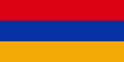
| Flag of Armenia | |
Armenia is a unitary, multi-party, democratic nation-state with an ancient cultural heritage. The first Armenian state of Urartu was established in 860 BC, and by the 6th century BC it was replaced by the Satrapy of Armenia. The Kingdom of Armenia reached its height under Tigranes the Great in the 1st century BC and in the year 301 became the first state in the world to adopt Christianity as its official religion. The ancient Armenian kingdom was split between the Byzantine and Sasanian Empires around the early 5th century. Under the Bagratuni dynasty, the Bagratid Kingdom of Armenia was restored in the 9th century. Declining due to the wars against the Byzantines, the kingdom fell in 1045 and Armenia was soon after invaded by the Seljuk Turks. An Armenian principality and later a kingdom Cilician Armenia was located on the coast of the Mediterranean Sea between the 11th and 14th centuries.
Currency / Language
| ISO | Currency | Symbol | Significant figures |
|---|---|---|---|
| AMD | Armenian dram | Ö | 2 |
| ISO | Language |
|---|---|
| HY | Armenian language |


